|
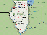
Welcome to Illinois!
With a population near 40,000 between 1300 and 1400 AD, the Mississippian-culture city of Cahokia, in what is now southern Illinois, was the largest city within the future United States until after 1790, when it was surpassed by New York City. Gradually Cahokia and the area were abandoned, and at the time of the American Revolution, only about 2,000 Native American hunters and a small number of French villagers inhabited the Illinois area. United States migrant settlers began arriving from Kentucky in the 1810s; Illinois achieved statehood in 1818. The future metropolis of Chicago was founded in the 1830s on the banks of the Chicago River, one of the few natural harbors on southern Lake Michigan. Railroads and John Deere's invention of the self-scouring steel plow made central Illinois' rich prairie into some of the world's most productive and valuable farmlands, attracting immigrant farmers from Germany and Sweden. By 1900, the growth of industrial jobs in the northern cities and coal mining in the central and southern areas attracted immigrants from Eastern and Southern Europe. Its manufacturing made the state a major arsenal in both World wars. The Great Migration of African Americans from the rural South to Chicago formed a large and important community that created the city's famous jazz and blues cultures. Approximately 74% of the population of Illinois resides in the northeastern corner of the state, primarily within the city of Chicago and the surrounding area. Three U.S. Presidents have been elected while they were living in Illinois - Abraham Lincoln, Ulysses S. Grant, and Barack Obama. Ronald Reagan was born in Tampico and grew up in Dixon. Lincoln is interred at Oak Ridge Cemetery in Springfield. The Northeastern border of Illinois is Lake Michigan. Its eastern border with Indiana is the Wabash River and a north-south line above Post Vincennes, 87°31'30'' west longitude. Its northern border with Wisconsin is fixed at 42°30' north latitude. Its western border with Missouri and Iowa is the Mississippi River. Its southern border with Kentucky is the Ohio River. Illinois also borders Michigan, but only via a water boundary in Lake Michigan. Though Illinois lies entirely in the Interior Plains, it has three major geographical divisions. The first is Northern Illinois, dominated by the Chicago metropolitan area, including the city of Chicago, its suburbs, and the adjoining exurban area into which the metropolis is expanding. As defined by the federal government, the Chicago metro area includes a few counties in Indiana and Wisconsin and stretches across much of northeastern Illinois. It is a cosmopolitan city, densely populated, industrialized, and settled by a wide variety of ethnic groups. The city of Rockford, the second largest metropolitan area and the state's third largest city sits along Interstates 39 and 90 some 75 miles (121 km) northwest of Chicago. Southward and westward, the second major division is Central Illinois, an area of mostly prairie. Known as the Heart of Illinois, it is characterized by small towns and mid-sized cities. The western section (west of the Illinois River) was originally part of the Military Tract of 1812 and forms the distinctive western bulge of the state. Agriculture, particularly corn and soybeans, as well as educational institutions and manufacturing centers, figure prominently. Cities include Peoria, the third largest metropolitan area in Illinois at 370,000; Springfield, the state capital; Quincy; Decatur; Bloomington-Normal; and Champaign-Urbana. The Illinois Quad Cities, as of 2008, had a population of 377,625 and is almost at the same latitude as Chicago. They are sometimes grouped in Central Illinois due to economic, political, and cultural ties to this region. This population actually makes it the third largest metropolitan area in Illinois. However, since its area spans two states, namely Illinois and Iowa, it is not usually considered the third largest metropolitan area. The third division is Southern Illinois, comprising the area south of U.S. Route 50, and including Little Egypt, near the juncture of the Mississippi River and Ohio River. This region can be distinguished from the other two by its warmer climate, different variety of crops (including some cotton farming in the past), more rugged topography (the southern tip is unglaciated with the remainder glaciated during the Illinoian Stage and earlier ages), as well as small-scale oil deposits and coal mining. The area is a little more populated than the central part of the state with the population centered in two areas. First, the Illinois suburbs of St. Louis comprise the second most populous metropolitan area in Illinois with nearly 600,000 inhabitants, and are known collectively as the Metro-East. The second area is Williamson County, Jackson County, Franklin County, Saline County and Perry County. It is home to around 210,000 residents and is known collectively as Metro Lakeland. The region outside of the Chicago Metropolitan area is often described as 'downstate Illinois'. However, residents of central and southern Illinois view their regions as geographically and culturally distinct, and do not necessarily use this term. In extreme northwestern Illinois, the Driftless Area, a region of unglaciated and therefore higher and more rugged topography, occupies a small part of the state. Charles Mound, located in this region, has the state's highest elevation above sea level at 1,235 feet (376 m). The highest structure in Illinois is Willis Tower with a roof elevation of approximately 2,034 feet (620 m) above sea level. [Chicago elevation (580 ft) + tower height (1454 ft) = 2034.] The floodplain on the Mississippi River from Alton to the Kaskaskia River is the American Bottom, and is the site of the ancient city of Cahokia. It was a region of early German settlement, as well as the site of the first state capital, at Kaskaskia which is separated from the rest of the state by the Mississippi River. Because of its nearly 400 miles (644 km) length and mid-continental situation, Illinois has a widely varying climate. Most of Illinois has a humid continental climate (Köppen climate classification Dfa), with hot, humid summers and cool to cold winters. The southernmost part of the state, from about Carbondale southward, borders on a humid subtropical climate (Koppen Cfa), with more moderate winters. Average yearly precipitation for Illinois varies from just over 48 inches (1,219 mm) at the southern tip to around 35 inches (889 mm) in the northern portion of the state. Normal annual snowfall exceeds 38 inches (965 mm) in the Chicago area, while the southern portion of the state normally receives less than 14 inches (356 mm). The all time high temperature was 117 °F (47 °C), recorded on 14 July 1954, at East St. Louis, Illinois, while the all time low temperature was -36 °F (-38 °C), recorded on 5 January 1999, at Congerville, Illinois. Illinois averages around 51 days of thunderstorm activity a year, which ranks somewhat above average in the number of thunderstorm days for the United States. Illinois is vulnerable to tornadoes with an average of 35 occurring annually, which puts much of the state at around five tornadoes per 10,000 square miles (30,000 km2) annually. The deadliest tornadoes on record in the nation have occurred largely in Illinois. The Tri-State Tornado of 1925 killed 695 people in three states, 613 of whom lived in Illinois. Though this figure can be attributed to the historically higher population of Illinois compared to neighboring states (past to present) as well as modern developments in storm tracking, death tolls due to tornadoes have dramatically declined. As of 2008, Illinois has an estimated population of 12,901,563, which is an increase of 75,754 from the prior year and an increase of 481,903 or 3.9%, since the year 2000. This includes a natural increase since the last census of 644,967 people; that is, 1,505,709 births minus 860,742 deaths and a decrease due to the net migration of 159,182 people out of the state. International immigration to the state resulted in an increase of 425,893 people and domestic migration produced a loss of 585,075 people. As of the 2007 estimates from the U.S. Census Bureau, there were 1,768,518 foreign-born inhabitants of the state or 13.8% of the population, with 48.4% from Latin America, 24.6% from Asia, 22.8% from Europe, 2.9% from Africa, 1.2% from Northern America and 0.2% from Oceania. Of the foreign-born population, 43.7% were naturalized U.S. citizens and 56.3% were not U.S. citizens. Additionally, the racial distributions were as follows: 65.0% White American, 15.0% African American, 14.9% Latino American, 4.3% Asian American, 0.3% American Indian and Alaska Natives, and 0.1% Native Hawaiians and Pacific Islander American. In 2007, 6.9% of Illinois' population was reported as being under age 5, 24.9% under age 18 and 12.1% were age 65 and over. Females made up approximately 50.7% of the population. According to the 2007 estimates, 21.1% of the population had German ancestry, 13.3% had Irish ancestry, 7.9% had Polish ancestry, 6.7% had English ancestry, 6.4% had Italian ancestry, 4.6% listed themselves as American, 2.4% had Swedish ancestry, 2.2% had French ancestry, other than Basque, 1.6% had Dutch ancestry, 1.4% had Norwegian ancestry and 1.3% had Scottish ancestry. Also, 21.8% of the population age 5 years and over reported speaking a language other than English, with 12.8% of the population speaking Spanish, 5.6% speaking other Indo-European languages, 2.5% speaking Asian and Austronesian languages, and 0.8% speaking other languages. At the northern edge of the state on Lake Michigan lies Chicago, the nation's third largest city. In 2000, 23.3% of the population lived in the city of Chicago, 43.3% in Cook County and 65.6% in the counties of the Chicago metropolitan area: Will, DuPage, Kane, Lake and McHenry counties, as well as Cook County. The remaining population lives in the smaller cities and rural areas that dot the state's plains. There are many attractions in Illinois. There are forests, lakes, rivers, and mountains. So what are you waiting for. Come to Illinois and see for youself. |
|
Good information about the state of Illinois can be found on the following web sites: |
|
|
 Illinois (pronounced IL-i-NOY), the 21st state admitted to the United States of America, is the most populous and demographically diverse Midwestern state and the fifth most populous state in the nation. With Chicago in the northeast, small industrial cities and great agricultural productivity in central and western Illinois, and natural resources like coal, timber, and petroleum in the south, Illinois has a broad economic base. Illinois is an important transportation hub; the Port of Chicago connects the Great Lakes to the Mississippi River via the Illinois River. Illinois is often viewed as a microcosm of the United States; an Associated Press analysis of 21 demographic factors found Illinois the 'most average state', while Peoria has long been a proverbial social and cultural bellwether.